Casco Bay is the western-most body of water on the Maine Coast where cruising boats explore inlets, bays and coves. So it was for our cruising plans. The Basin, our hurricane hole on the easternmost New Meadows River, was our introduction. The next few days after Hurricane Lee passed were spent exploring Casco Bay. Sebasco is on the eastern side. Portland is on the western side.
Our first stop after Hurricane Lee passed was Safe Harbor Great Island Marina in Orr's Cove. The Marina is distinctive. It is run by retired engineers and has a strong emphasis on process control. This is now coupled with the Marina just having been bought by the Safe Harbor network. That means a new source of capital is now available.
Look at this Travelift, one of the highest capacity Travelifts we encountered on the Maine coast. In addition, the Travelift runs on a substantial structure that goes out over the cove to launch and retrieve boats of all sizes. It is impressive. A Brio sister ship in these slings, waiting to be launched after the threat of the Hurricane had passed.

Here's the view from the land side of the Travelift, looking out to the end of the run. Fear of heights? Hope not. You have to love the reflection of the boat in the water!

You can see the well-maintained docks upstream from the Travelift.

Prior to coming in the the Marina for a couple of nights to recover from our several das at anchor in the Hurricane, we grabbed a mooring just north of Snow Island to enjoy the beauty.
Don't worry, we didn't hit "Destiny", although the chart system alerts us of such a potential.

Here's the view on leaving Great Island, looking back to the Marina.

And forward to the mouth of our narrow bay. Who would have guessed a storm had passed just a couple of days before!

We now entered Casco Bay. You can see all of the fingers of land jutting out into the Bay.

The right-hand pen points to Cape Small. A couple of inches above the pen point is The Basin. Great Island Marina is at the north end of Quahog Bay. Portland is just above the left-hand pen's point.
Originally, we had planned to spend our last night of the trip anchored at Jewell Island, which is just north of the word "CASCO" in Casco Bay. It is a jewell. Bu instead we went to the northwest corner of Caco Bay to Harraseeket River. This is near L.L. Bean and Freeport. It is very accessible to I-95 and the busy life of Maine.
Coming into the Harraseeket River, we pass "Pound of Tea", a tiny island with a house on it.

Leaving this to starboard, we entered the River where we grabbed a mooring.
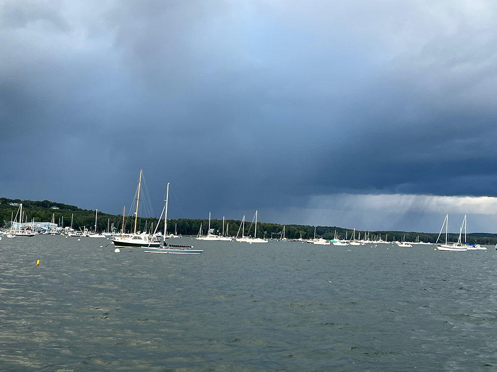
The skies began to darken and became threatening. The idea of just staying on the mooring for the night was attractive. Besides, we knew we had to leave early the next morning to cross the Gulf of Maine and get back to the Cape Cod Canal and Marion.

You can see the rain in sweeping curtains above the boats on the right. Fortunately, we stayed pretty dry, but the wind kicked up.
By supper, things were calming down and we had a red sky at night (sailor's delight).

Once the sun set, there was a pretty moon off our stern.

All was calm. We rested well, knowing we had a ten-hour crossing to make to Marion with an early start the next day.
The upper pen is the Harraseeket River.
The compass rose of shipping channels (the pink bands show the separation zones between incoming and outgoing traffic) lies off of Portland. We pass through this area as we motor south.

Boston Harbor is near the pen clip of the lower pen. The point of the lower pen covers Plymouth. To its right is Provincetown. The entrance to the Cape Cod Canal is about ten nautical miles below the tip of the pen. From the Harraseeket River to the Canal is about 110 nautical miles. We covered the trip in about 5 hours and stopped at the marina in Sandwich to fuel Brio. Then we went through the Canal and on to Burr Brothers marina in Marion, Massachusetts. We arrived at 2:30 pm to our welcoming wives!
Brio was happy, too.
Cheers,
Brio


Comentarios