

Brio rose over 420 feet from Troy, New York and the Hudson River to Rome, New York. Rome is not the highest point on the Erie Canal. But It does define an important divide between the Hudson and Lake Ontario. Further west, the Canal forms a divide between Lake Ontario and rivers flowing south to the Atlantic Ocean. As such, the areas from Rome west were sites of many battlefields during the French and Indian War (1755 to 1763) as control was sought between the French and their allies within the several Indian nations and the British and Americans on the other side. Battles continued between the British and the Americans in this same region during the Revolutionary War and the War of 1812.
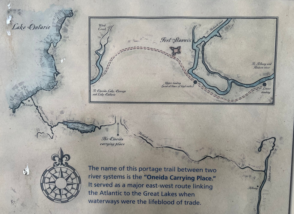
The Carrying Place is so named because this was the area of portage between the headwaters of the Mohawk River to the east and Wood Creek to the west. Look at the map below. You can see Albany to the east (right). The Mohawk River rises to the west. You can see a string of British forts near the headwaters, to the east of the Oneida Carrying Place. Then, to the west is an unnamed stream (Wood Creek) flowing into Oneida Lake.
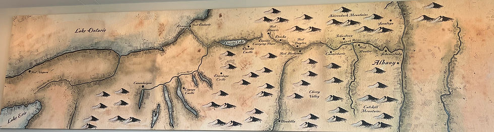
At the Carrying Place, the British built many forts, culminating in Fort Stanwix.
It was critical to control the western frontier. Battles between the Indians in Quebec and Ontario and in the western British colonies fought to preserve their way of life in the face of building pressures to settle and pacify the region. The French seemed more adept at developing working relations with the Indians than were the British, beginning with Samuel de Champlain in the 1600s. Such background led to the tensions that culminated in the French and Indian War and the eventual conquering of Nova Scotia, Quebec and Ontario by the British.
The Carrying Place was a natural focal point of strife as well as trade and transit for all of these parties. But it was the British, in building Fort Stanwix in what is now Rome, NY, that ultimately controlled the western frontier in what became New York State. After the War of 1812, the Americans no longer viewed such control as critical here and transferred their efforts west to Ohio and further west.
To give you an idea of just how meandering the Mohawk River is as it flows from Rome east through Utica, look at the chart below. The Erie Canal is to the right and is as straight as an arrow. The Mohawk River is to the left and this was the path traveled by canoes both east and west.

Here is an artist's rendition of English traders and Indians exchanging goods near the Oneida Carrying Place.

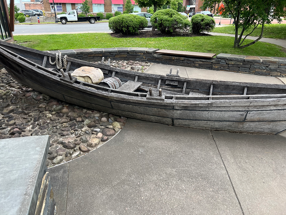
Here is a replica of the canoes used for trade. They are flat-bottomed because the rivers and creeks were very shallow.
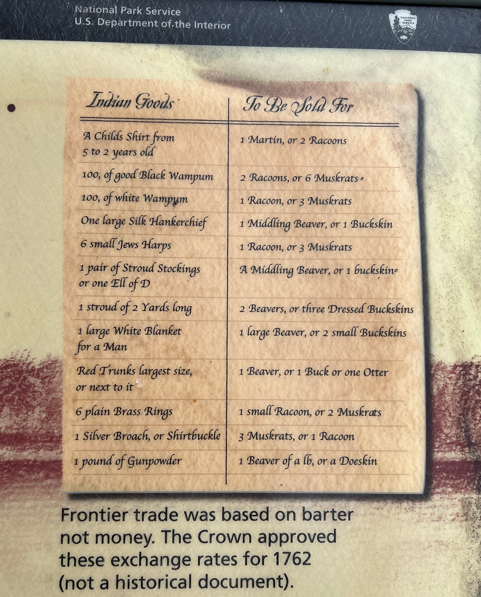
Below is the "official" trading terms for translating Indian goods to British goods. Clearly what's missing here is firearms and liquor. Both were critical in fighting and "greasing" terms of treaties.
Fort Stanwix itself was first built in 1755. As a structure, it clearly dominated the area.
Behind these walls, cannon were positioned to fire on the path that led through the Carrying Place. It was also a defensive structure, as can be seen in the second picture.


Modern history of the Fort is fascinating. It was first "rediscovered" during the Depression. By 1969, funds had been raised to acquire land in the city of Rome. To prepare for the Bicentennial, the "footprint" of the Fort had been reclaimed and existing structures were torn down. Over the next several decades, the Fort was built using many traditional construction methods. Today one can walk through the Fort and observe rooms and buildings within the Fort showing what life was like during the French and Indian War and the Revolutionary War.
Cheers,
Brio
Commentaires